
Trace an Ann Arbor Street Directory
Address research in Ann Arbor works best as a sequence, not a single result. Begin with the county parcel form to identify the parcel and taxpayer record, then use its legal description to test a deed. A map can show which parcel faces a road or sits at a corner. A directory listing can then place a named occupant at an address in a particular edition. The Michigan Voter Information Center is useful only for a voter checking their own registration status; broader public voter data has a separate request process and protected fields are withheld. These sources answer different questions, so label the result by source and date.
- Enter the street number and street name in the Washtenaw Property/Parcel Lookup, selecting City of Ann Arbor or the appropriate township.
- Save the parcel number, situs address, taxpayer name, municipality, and legal description before changing the query.
- Open MapWashtenaw to orient the parcel, inspect nearby roads, and check a corner or boundary question.
- Search the current taxpayer as grantee in the Washtenaw land-record index, then retain the grantor, recording placement, and document type.
- For earlier address snapshots, use the AADL street listings inside its digitized directory editions and compare the original page image.
Note: A result should be described as a parcel, deed, map, or dated directory record, not as a complete current household list.
Search Ann Arbor Streets in Parcel Form
The county form is the strongest first stop for an Ann Arbor street directory search because it accepts both a single street number and a From/To range. Type the street name without its type, so use “Main” rather than “Main St.” Choose the municipality carefully. The menu distinguishes the City of Ann Arbor from Ann Arbor Township and many other county localities. A street that crosses a jurisdictional edge may need separate searches. The form has no ZIP field, because it is organized around parcel and municipal records rather than postal delivery areas.
| Parcel-form field | How to use it for an Ann Arbor street search |
|---|---|
| Parcel Number | Optional 12-character identifier, shown in the form as XX-XX-XX-XXX-XXX. |
| Street Name | Optional name-only field. Leave off St., Ave., Rd., and similar street types. |
| Street Number | Optional exact address number for a single parcel. |
| From / To numbers | Optional paired fields for walking a portion of a street by number range. |
| City, Village, or Township | Optional selector that distinguishes City of Ann Arbor from township and other local records. |
| Taxpayer Name | Optional name field entered last name first. |
Run a second search if the first one misses. Directionals, a corner parcel, an official complex label, or an old subdivision description can affect an address match. A parcel number is the stable key once found. If an older number will not resolve, retain it alongside the current parcel ID rather than treating the failed query as proof that the property disappeared. Save the returned range before revising the query, since a later search can replace the result set on screen.
Read Ann Arbor Street Parcel Fields
The parcel report separates the situs address from the taxpayer mailing address. Situs means the physical parcel location. The mailing line is tax correspondence and may identify a person or organization connected to the property, but it does not establish who lives there. The report also includes property classification, school district, assessment year, State Equalized Value, taxable value, Principal Residence Exemption percentage, legal description, and sales-history fields. PRE is a tax-status detail, not a roster of residents.
- Parcel
- A locally assigned property record used to join tax, assessment, map, and deed research.
- Situs address
- The location of the parcel itself. It can differ from the taxpayer's mailing address.
- Plat
- A recorded map that lays out lots, blocks, or a subdivision. It can bridge an old street reference to a legal description.
- Criss-cross directory
- A historical street listing that works from address toward a named listing for that edition.
For a whole street, keep a separate row for every parcel. That prevents a taxpayer mailing address, sales item, or legal clue from one lot being copied onto another. The county says parcel data comes from local municipalities and should be verified with the local assessor when a decision depends on it.
Map Ann Arbor Streets with MapWashtenaw
MapWashtenaw adds the visual part of an Ann Arbor street directory search. After accepting the viewer terms, search or zoom to an address or street, click the parcel, and follow its details back to the tax or assessment record. Parcel outlines, aerial imagery, natural features, topography, street centerlines, and other local layers can help distinguish a rear lot from a street-facing parcel. The dynamic viewer's exact control names can change, so use the visible search, layer, and parcel-detail options rather than assuming a particular button.
View the Washtenaw parcel summary report interface captured for this Ann Arbor street directory.
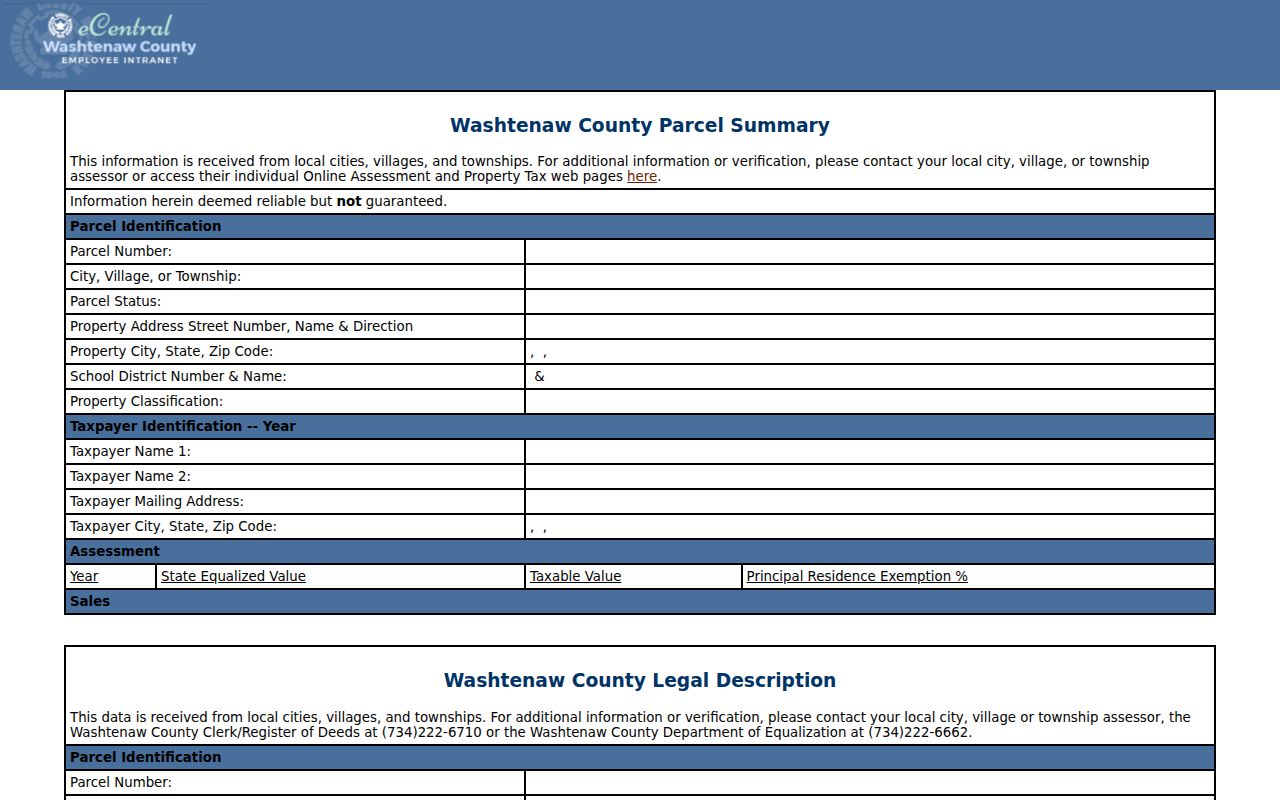
The report makes the useful split visible: parcel and situs details identify the property record, while taxpayer and mailing fields need separate, dated interpretation.
Ann Arbor Street Records by Custodian
No one Ann Arbor street record provides all of the facts behind an address. The property roll supplies current parcel and taxpayer information. GIS supplies spatial context. Recorded instruments supply an ownership trail. Permit systems can date a project. A directory is a historical snapshot. Start with the source that matches the question, then use a second, independent record to confirm a meaningful connection.
| Address-keyed record | Ann Arbor or Washtenaw custodian | Useful result | Access route |
|---|---|---|---|
| Parcel and tax roll | Equalization and local assessor | Taxpayer, situs, mailing clue, legal description, values, PRE | County parcel lookup or municipal BS&A records; verify locally |
| Parcel map | Washtenaw GIS and city GIS | Parcel shape, roads, boundaries, and map layers | MapWashtenaw or city GIS, both for reference |
| Recorded deed | Clerk/Register of Deeds | Grantor, grantee, instrument, legal-description trail | Free index; login for online copies or mail request |
| Permit or project | City records systems | Project, owner or contractor labels, inspection dates, attachments | OnBase, A2Trak, Stream, or city FOIA route by era |
| Street listing | Ann Arbor District Library | Dated name and address listing, sometimes household notation | Digitized edition, downtown print, or archive assistance |
The table is a chain, not a set of substitutes. A directory can show a historical name at an address without proving ownership. A deed can establish a conveyance without showing occupancy. Keeping those distinctions makes a street-by-street result far more reliable.
Follow Ann Arbor Street Deed Links
Once a parcel is identified, the Register of Deeds index is the ownership-history layer for a street directory result. Search the current owner as grantee to locate the purchase instrument, then read the grantor as the prior owner and work backward. Keep the recording date, document type, liber and page or document number, names, and legal description together. If a street address fails in an older instrument, search the lot, block, subdivision, parcel history, legal description, or recorded placement instead. A street address is not the legal title key.
The online land-record search offers free public index access. The county does not publish a verified online start year, so do not assume that an online miss ends the trail. A registered login is needed to purchase copies online. The fallback is the Register of Deeds copy-request form, which asks for identifying document details and charges $1 per page plus $5 for each certified document. Mail requests also require payment and a self-addressed stamped envelope.
Note: Record the index entry first, then request only the document needed to test the legal description or ownership sequence.
Date Ann Arbor Street Permits
Permit records add a project timeline to an Ann Arbor street search. They can show an application, inspection, plan, certificate, or project contact, but they do not prove who lived at the property. The City of Ann Arbor divides access by era: OnBase covers material from about 1930 through 2007, A2Trak covers 2008 through March 2022, and Stream covers April 2021 to the present. The overlap means a date range and record number are more useful than a broad search phrase.
See the Ann Arbor A2Trak property-search screen used for the street directory image.
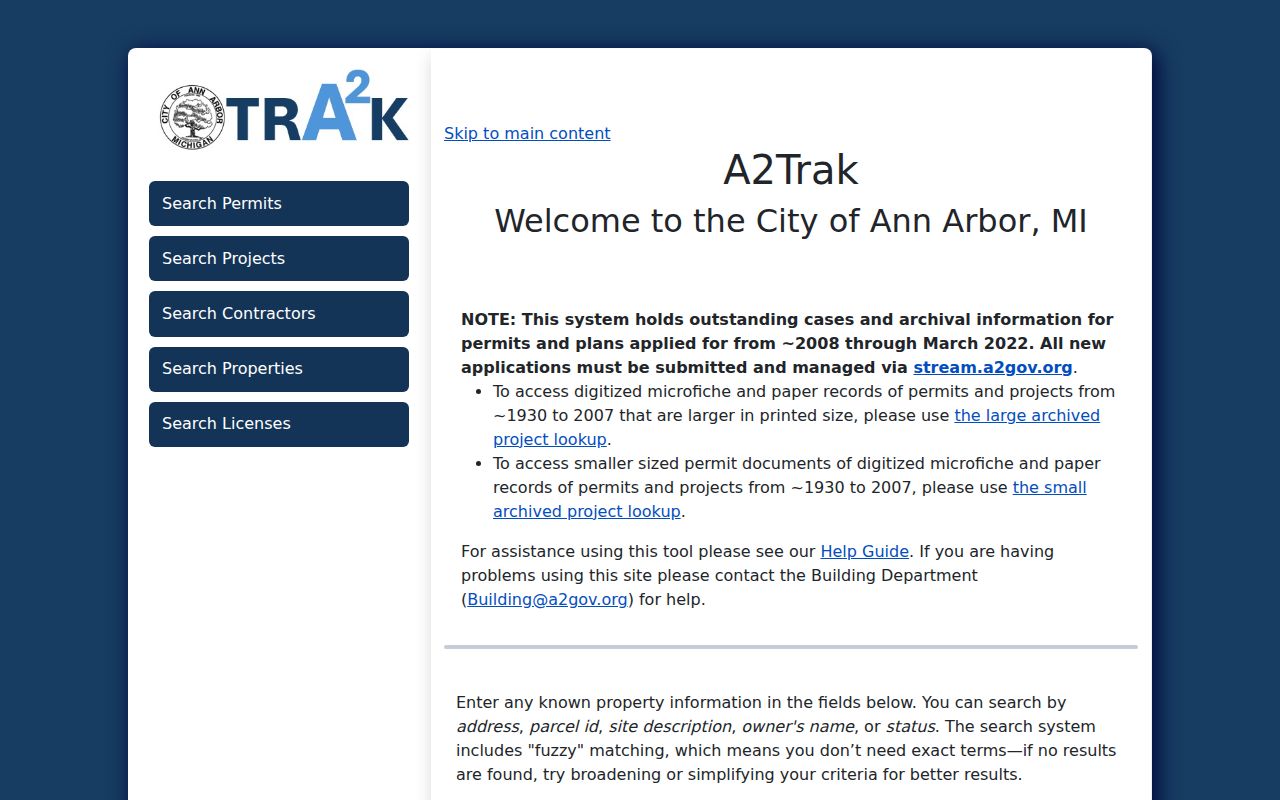
A2Trak supports fuzzy address, parcel ID, site description, owner, and status searching. The city advises broadening a permit search by using only the number or street name and omitting the street type when needed.
When an online result stops, use the Ann Arbor records-request and FOIA route with the address, date range, and known permit or project number. That gives the custodian a retrievable request rather than an unsupported guess.
Read Ann Arbor Street Listings
The historical layer of an Ann Arbor street directory is held in the AADL City and County Directories collection. Listed editions span 1868 through 2001, though the collection does not claim an edition for every calendar year. Street sections work as reverse listings for the period: open the edition, find the address, and save its publisher, page, spelling, direction, and any “res” or “bds” notation. OCR helps locate a term, but the page image is the record to verify.
These listings are strongest for a dated occupant clue. They may name a boarder, business, or institution, and they do not create a full household list. The collection and its editions are described in more detail in the Ann Arbor city directory section.
Check Ann Arbor Street Township Lines
Municipality is a working part of street research in Ann Arbor. The city expanded through annexation while township islands remained, so a postal Ann Arbor address can sit in a different municipal record context. The county form's municipality selector and the parcel ID are more dependable research keys than a ZIP code alone. Preserve the street direction, current parcel number, any older identifier, legal description, and selected municipality when records span an annexation or parcel change.
Older records may use a different city, township, or county label for the same piece of land. When the search shifts across that line, test the alternate municipality and compare the legal description before joining records. City-initiated annexation began with a strategic process in 2011, completed its first round in 2016, and had later decisions and appeals from 2021 through 2023. Those events explain why the municipality field deserves the same care as a street number.
The Ann Arbor BS&A municipal-records portal is another property and tax route for city parcels.
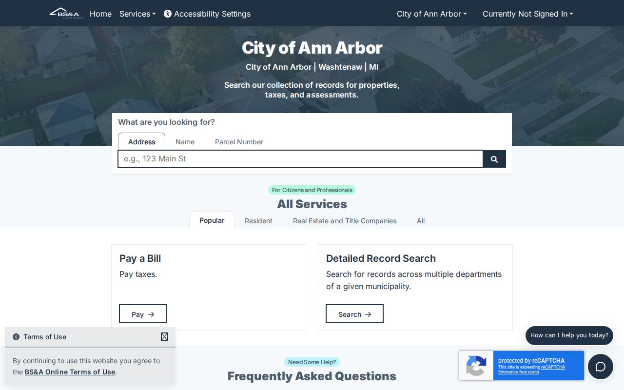
BS&A displays municipal record options alongside property, sale, tax, and special-assessment research. It supports the county parcel result but does not replace the recorded deed or a survey.
Limits of the Ann Arbor Street Directory
An Ann Arbor street directory cannot reveal every person connected to an address. Public parcel records do not list all occupants. Utility and delivery customer lists are not public rolls, Michigan driver and vehicle information is not a public address shortcut, and protected addresses must not be reconstructed. The Michigan Address Confidentiality Program provides a designated address for qualifying people at risk of harm. A missing name can reflect the kind of record, its date, a protected address, a change in parcel or municipality, or an unlisted historical occupant.
Lawful use. Ann Arbor street records support family history, property research, and civic curiosity. Do not use an address trail to stalk, harass, intimidate, or harm anyone.